-
-
Save MatzeKitt/21a001c542dfa2c0e159f7971d41e7c6 to your computer and use it in GitHub Desktop.
| // Variables used by Scriptable. | |
| // These must be at the very top of the file. Do not edit. | |
| // icon-color: deep-gray; icon-glyph: magic; | |
| // Licence: Robert Koch-Institut (RKI), dl-de/by-2-0 | |
| // | |
| // ------------- | |
| // Configuration | |
| // ------------- | |
| // whether a second graph with old data (-7 days) should be draw for comparison | |
| const drawOldData = true; | |
| // whether to shorten big numbers, e. g. 10.256 becomes 10,2k | |
| const shortenBigNumbers = true; | |
| // --------------------------- | |
| // do not edit after this line | |
| // --------------------------- | |
| const DAY_IN_MICROSECONDS = 86400000; | |
| const lineWeight = 2; | |
| const vertLineWeight = .5; | |
| const accentColor1 = new Color( '#33cc33', 1 ); | |
| const accentColor2 = Color.lightGray(); | |
| const apiUrl = ( location ) => `https://services7.arcgis.com/mOBPykOjAyBO2ZKk/arcgis/rest/services/RKI_Landkreisdaten/FeatureServer/0/query?where=1%3D1&outFields=GEN,cases,deaths,cases7_per_100k,cases7_bl_per_100k,BL,county&geometry=${ location.longitude.toFixed( 3 ) }%2C${ location.latitude.toFixed( 3 ) }&geometryType=esriGeometryPoint&inSR=4326&spatialRel=esriSpatialRelWithin&returnGeometry=false&outSR=4326&f=json`; | |
| const widgetHeight = 338; | |
| const widgetWidth = 720; | |
| const graphLow = 280; | |
| const graphHeight = 160; | |
| const spaceBetweenDays = 44.5; | |
| const saveIncidenceLatLon = ( location ) => { | |
| let fm = FileManager.iCloud(); | |
| let path = fm.joinPath( fm.documentsDirectory(), 'covid19latlon.json' ); | |
| fm.writeString( path, JSON.stringify( location ) ); | |
| }; | |
| const getSavedIncidenceLatLon = () => { | |
| let fm = FileManager.iCloud(); | |
| let path = fm.joinPath( fm.documentsDirectory(), 'covid19latlon.json' ); | |
| let data = fm.readString( path ); | |
| return JSON.parse( data ); | |
| }; | |
| let drawContext = new DrawContext(); | |
| drawContext.size = new Size( widgetWidth, widgetHeight ); | |
| drawContext.opaque = false; | |
| let widget = await createWidget(); | |
| widget.setPadding( 0, 0, 0, 0 ); | |
| widget.backgroundImage = ( drawContext.getImage() ); | |
| await widget.presentMedium(); | |
| Script.setWidget( widget ); | |
| Script.complete(); | |
| async function createWidget( items ) { | |
| let location; | |
| if ( args.widgetParameter ) { | |
| console.log( 'get fixed lat/lon' ); | |
| const fixedCoordinates = args.widgetParameter.split( ',' ).map( parseFloat ); | |
| location = { | |
| latitude: fixedCoordinates[ 0 ], | |
| longitude: fixedCoordinates[ 1 ] | |
| }; | |
| } | |
| else { | |
| Location.setAccuracyToThreeKilometers(); | |
| try { | |
| location = await Location.current(); | |
| console.log( 'get current lat/lon' ); | |
| saveIncidenceLatLon( location ); | |
| } | |
| catch ( e ) { | |
| console.log( 'using saved lat/lon' ); | |
| location = getSavedIncidenceLatLon(); | |
| } | |
| } | |
| const locationData = await new Request( apiUrl( location ) ).loadJSON(); | |
| if ( ! locationData || ! locationData.features || ! locationData.features.length ) { | |
| const errorList = new ListWidget(); | |
| errorList.backgroundColor = new Color( '#191a1d', 1 ); | |
| errorList.addText( 'Keine Ergebnisse für den aktuellen Ort gefunden.' ); | |
| return errorList; | |
| } | |
| const attr = locationData.features[ 0 ].attributes; | |
| const cityName = attr.GEN; | |
| const county = attr.county; | |
| const list = new ListWidget(); | |
| const date = new Date(); | |
| date.setTime( date.getTime() - 23 * DAY_IN_MICROSECONDS ); | |
| const minDate = ( '0' + ( date.getMonth() + 1 ) ).slice( -2 ) + '-' + ( '0' + date.getDate() ).slice( -2 ) + '-' + date.getFullYear(); | |
| const apiUrlData = `https://services7.arcgis.com/mOBPykOjAyBO2ZKk/ArcGIS/rest/services/Covid19_RKI_Sums/FeatureServer/0/query?where=Landkreis+LIKE+%27%25${ encodeURIComponent( county ) }%25%27+AND+Meldedatum+%3E+%27${ encodeURIComponent( minDate ) }%27&objectIds=&time=&resultType=none&outFields=*&returnIdsOnly=false&returnUniqueIdsOnly=false&returnCountOnly=false&returnDistinctValues=false&cacheHint=false&orderByFields=Meldedatum&groupByFieldsForStatistics=&outStatistics=&having=&resultOffset=&resultRecordCount=&sqlFormat=none&f=json&token=`; | |
| date.setTime( ( date.getTime() + 7 * DAY_IN_MICROSECONDS ) ); | |
| const cityData = await new Request( apiUrlData ).loadJSON(); | |
| if ( ! cityData || ! cityData.features || ! cityData.features.length ) { | |
| const errorList = new ListWidget(); | |
| errorList.backgroundColor = new Color( '#191a1d', 1 ); | |
| errorList.addText( 'Keine Statistik gefunden.' ); | |
| return errorList; | |
| } | |
| list.backgroundColor = new Color( '#191a1d', 1 ); | |
| drawContext.setTextColor( Color.white() ); | |
| drawContext.setFont( Font.mediumSystemFont( 26 ) ); | |
| drawContext.drawText( '🦠 Statistik'.toUpperCase() + ' ' + cityName, new Point( 25, 25 ) ); | |
| drawContext.setTextAlignedCenter(); | |
| let data = {}; | |
| let oldData = {}; | |
| for ( const dataset of cityData.features ) { | |
| if ( drawOldData && dataset.attributes.Meldedatum < date.getTime() ) { | |
| // get old data | |
| if ( typeof oldData[ dataset.attributes.Meldedatum ] === 'undefined' ) { | |
| oldData[ dataset.attributes.Meldedatum ] = { | |
| Meldedatum: dataset.attributes.Meldedatum, | |
| AnzahlFall: 0, | |
| }; | |
| } | |
| oldData[ dataset.attributes.Meldedatum ].AnzahlFall += parseInt( dataset.attributes.AnzahlFall ); | |
| } | |
| else if ( dataset.attributes.Meldedatum >= date.getTime() ) { | |
| // get old data | |
| if ( drawOldData && dataset.attributes.Meldedatum < date.getTime() + 8 * DAY_IN_MICROSECONDS ) { | |
| if ( typeof oldData[ dataset.attributes.Meldedatum ] === 'undefined' ) { | |
| oldData[ dataset.attributes.Meldedatum ] = { | |
| Meldedatum: dataset.attributes.Meldedatum, | |
| AnzahlFall: 0, | |
| }; | |
| } | |
| oldData[ dataset.attributes.Meldedatum ].AnzahlFall += parseInt( dataset.attributes.AnzahlFall ); | |
| } | |
| // get current data | |
| if ( typeof data[ dataset.attributes.Meldedatum ] === 'undefined' ) { | |
| data[ dataset.attributes.Meldedatum ] = { | |
| Meldedatum: dataset.attributes.Meldedatum, | |
| AnzahlFall: 0, | |
| }; | |
| } | |
| data[ dataset.attributes.Meldedatum ].AnzahlFall += parseInt( dataset.attributes.AnzahlFall ); | |
| } | |
| } | |
| // get minimal value of current and old data | |
| const currentDataData = Object.values( data ); | |
| const oldDataData = Object.values( oldData ); | |
| let currentMin, currentMax, oldMin, oldMax; | |
| for ( let i = 0; i < currentDataData.length; i++ ) { | |
| let aux = currentDataData[ i ].AnzahlFall; | |
| currentMin = ( aux < currentMin || currentMin == undefined ? aux : currentMin ); | |
| currentMax = ( aux > currentMax || currentMax == undefined ? aux : currentMax ); | |
| } | |
| for ( let i = 0; i < oldDataData.length; i++ ) { | |
| let aux = oldDataData[ i ].AnzahlFall; | |
| oldMin = ( aux < oldMin || oldMin == undefined ? aux : oldMin ); | |
| oldMax = ( aux > oldMax || oldMax == undefined ? aux : oldMax ); | |
| } | |
| const min = currentMin <= oldMin ? currentMin : oldMin; | |
| const max = currentMax >= oldMax ? currentMax : oldMax; | |
| if ( drawOldData ) { | |
| drawChart( oldDataData, 'old', min, max ); | |
| } | |
| drawChart( currentDataData, 'current', min, max ); | |
| return list; | |
| } | |
| function drawChart( dataArray, chartType, min, max ) { | |
| let diff = max - min; | |
| const highestIndex = dataArray.length - 1; | |
| for ( let i = 0, j = highestIndex; i < dataArray.length; i++, j-- ) { | |
| const day = ( new Date( dataArray[ i ].Meldedatum ) ).getDate(); | |
| const dayOfWeek = ( new Date( dataArray[ i ].Meldedatum ) ).getDay(); | |
| const cases = dataArray[ i ].AnzahlFall; | |
| const delta = ( cases - min ) / diff; | |
| if ( i < highestIndex ) { | |
| const nextCases = dataArray[ i + 1 ].AnzahlFall; | |
| const nextDelta = ( nextCases - min ) / diff; | |
| const point1 = new Point( spaceBetweenDays * i + 50, graphLow - ( graphHeight * delta ) ); | |
| const point2 = new Point( spaceBetweenDays * ( i + 1 ) + 50, graphLow - ( graphHeight * nextDelta ) ); | |
| if ( chartType === 'current' ) { | |
| drawLine( point1, point2, lineWeight, accentColor1 ); | |
| } | |
| else { | |
| drawLine( point1, point2, 1, accentColor2 ); | |
| } | |
| } | |
| // Vertical Line | |
| if ( chartType === 'current' ) { | |
| const point1 = new Point( spaceBetweenDays * i + 50, graphLow - ( graphHeight * delta ) ); | |
| const point2 = new Point( spaceBetweenDays * i + 50, graphLow ); | |
| drawLine( point1, point2, vertLineWeight, accentColor2 ); | |
| let dayColor; | |
| if ( dayOfWeek == 0 || dayOfWeek == 6 ) { | |
| dayColor = accentColor2; | |
| } | |
| else { | |
| dayColor = Color.white(); | |
| } | |
| const casesRect = new Rect( spaceBetweenDays * i, ( graphLow - 40 ) - ( graphHeight * delta ), 100, 23 ); | |
| const dayRect = new Rect( spaceBetweenDays * i + 27, graphLow + 10, 50, 23 ); | |
| drawTextR( formatNumber( cases ), casesRect, dayColor, Font.systemFont( 22 ) ); | |
| drawTextR( day, dayRect, dayColor, Font.systemFont( 22 ) ); | |
| } | |
| } | |
| return min; | |
| } | |
| function drawTextR( text, rect, color, font ) { | |
| drawContext.setFont( font ); | |
| drawContext.setTextColor( color ); | |
| drawContext.drawTextInRect( new String( text ).toString(), rect ); | |
| } | |
| function drawLine( point1, point2, width, color ) { | |
| const path = new Path(); | |
| path.move( point1 ); | |
| path.addLine( point2 ); | |
| drawContext.addPath( path ); | |
| drawContext.setStrokeColor( color ); | |
| drawContext.setLineWidth( width ); | |
| drawContext.strokePath(); | |
| } | |
| function formatNumber( number ) { | |
| let tooBig = false; | |
| if ( shortenBigNumbers && number > 999 ) { | |
| tooBig = true; | |
| } | |
| // replace dot by comma | |
| number = number.toString().replace( '.', ',' ); | |
| // add thousands separator | |
| number = number.replace( /\B(?=(\d{3})+(?!\d))/g, '.' ); | |
| if ( tooBig ) { | |
| const thousandsSeparatorPosition = number.indexOf( '.' ); | |
| number = number.replace( '.', ',' ); | |
| number = number.substring( 0, thousandsSeparatorPosition + 2 ) + 'k'; | |
| } | |
| return number; | |
| } |
@tommesborg Das sind zwei verschiedene Services beteiligt, die heute nacheinander nicht verfügbar waren. Jetzt geht es jedenfalls wieder.
@marcusraitner ich hab mir mal das 7 Tage Widget geholt. Das läuft. Der Code von dieser Seite hier bringt noch immer "keine Ergebnisse für den Aktuellen Ort gefunden - LOG: get current lag/lon" hervor.
@thommesborg also bei mir funktionieren beide …
Weißt du, was die zweite Kurve bedeutet? Soll das vielleicht der Verlauf des letzten Monats sein?
Das ist der Vergleich zur vorherigen Woche. Die graue Linie ist demnach immer eine Woche vorher.
@MatzeKitt ich hab mich leider zu früh gefreut. Das Widget findet wieder keine lat/lon.
Andere Widgets oder Apps haben keine Probleme mit dem Standort. Ich denke daher nicht, dass es am Gerät liegt.
Wie sich herausgestellt hat, es gab gestern wohl keine Ergebnisse für meinen genauen Stadort. Nachdem ich die Standorterfassung auf ungefähren Standort geändert hatte, lief auch der Code sauber durch. Heute Morgen habe ich dann den Standort erneut auf genauen Standort umgestellt und bekomme nun auch hier wieder Ergebnisse angezeigt. Enschuldigt bitte die Störung.
Ich habe die Berechnung der Minimal- und Maximalwerte korrigiert, sodass nun sowohl die Daten der jeweils vorangegangenen Woche und der aktuellen Woche beachtet werden.
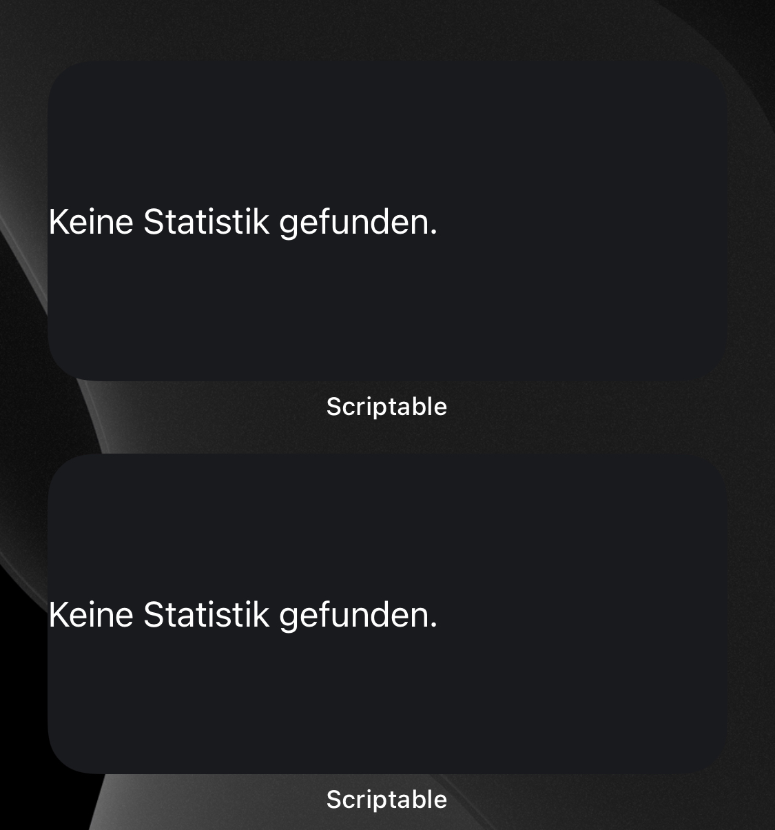
Hallo, seit gestern sehen die Widgets so aus. Ist das etwas bekanntes, das sich von selbst wieder einkriegt?
Hallo, seit gestern sehen die Widgets so aus. Ist das etwas bekanntes, das sich von selbst wieder einkriegt?
Ja, bei mir auch. Das liegt daran, dass die Schnittstelle, die das RKI für die Daten bereitstellte, jetzt einen Internal Server Error liefert: https://services7.arcgis.com/mOBPykOjAyBO2ZKk/arcgis/rest/services/Covid19_RKI_Sums/
Gab es immer wieder mal und ich hoffe es gibt sich wieder …
Das ist nur immer wieder eine Erinnerung, wie gut die Digitalisierung im öffentlichen Sektor ist. 🙂🙈
Das ist nur immer wieder eine Erinnerung, wie gut die Digitalisierung im öffentlichen Sektor ist. 🙂🙈
😂 Ok, da weiß ich Bescheid und ignoriere es.
😉 Aber irgendwie bin ich mir im Moment nicht sicher, ob diese Schnittstelle nicht komplett weg ist, weil ich sie im Katalog eine Ebene höher gar nicht mehr sehe: https://services7.arcgis.com/mOBPykOjAyBO2ZKk/arcgis/rest/services/
Oh, das wär schade.
Eine gute Alternative könnte sein: https://api.corona-zahlen.org/docs/ (und ich spendiere dem Autor davon gerne einen Kaffee!) Was meinst du @MatzeKitt?
Die Charts sind wieder da.
Ich sehe auch keinen Grund darin, wegen temporärer Ausfälle in diesem Fall eine andere API in Betracht zu ziehen. Aus mehreren Gründen:
- Ich weiß nicht, ob dort ähnliche Probleme auftraten oder auftreten werden.
- Ich weiß nicht, wer diesen Service betreibt und was dieser mit meinen personenbezogenen Daten macht, ganz gleich, was er einem verspricht.
- Das RKI ist eine öffentliche Stelle, bei der Transparenz zwingend vorhanden ist (siehe auch Punkt 2).
Man könnte sich eher überlegen, ob man die Daten zwischenspeichert, da diese sowieso nur einmal täglich vom RKI aktualisiert werden.
Zwischenspeichern halte ich für eine gute Idee. Wenn nicht, kann ich aber auch damit leben. Gute Arbeit!
Ich sehe auch keinen Grund darin, wegen temporärer Ausfälle in diesem Fall eine andere API in Betracht zu ziehen. Aus mehreren Gründen:
- Ich weiß nicht, ob dort ähnliche Probleme auftraten oder auftreten werden.
- Ich weiß nicht, wer diesen Service betreibt und was dieser mit meinen personenbezogenen Daten macht, ganz gleich, was er einem verspricht.
- Das RKI ist eine öffentliche Stelle, bei der Transparenz zwingend vorhanden ist (siehe auch Punkt 2).
Man könnte sich eher überlegen, ob man die Daten zwischenspeichert, da diese sowieso nur einmal täglich vom RKI aktualisiert werden.
Aus meiner Sicht, speichert diese API die Daten nur in verschiedener Form zwischen; ist eigentlich aber dieselbe Quelle. Ich habe es in meinem Skript mal umgebaut, aber grundsätzlich verstehe ich dein Argument auch sehr gut.
ist eigentlich aber dieselbe Quelle.
Das ja, mir geht es eher darum, dass man in Verbindung mit der IP-Adresse sowie den angegebenen Koordinaten (auch wenn diese auf drei Nachkommastellen gekürzt werden) ein ziemlich schönes Bewegungsprofil erstellen könnte.
Ich möchte damit nicht sagen, dass das dort passiert. Ich gehe davon aus, dass das nicht so ist. Auf der sichereren Seite ist man meiner Meinung nach aber mit der Verwendung der API des RKI.
Ok, das ist ein Argument. Bin mir aber nur nicht sicher, ob das Argument für oder gegen das RKI spricht. Bei https://github.com/marlon360/rki-covid-api habe ich wenigstens Einsicht in den Source-Code und kann genau das ausschließen, beim RKI nicht. Und wenn diese API dann noch die Zugriffe auf RKI bündelt, bin ich damit vielleicht sogar sicherer …
Was ich meine, kann man vollständig über die Zugriffsprotokolle am Server abbilden, ganz egal, ob die Applikation als solche Open Source ist oder nicht. 🙂
Ok, da hast du recht. Wobei ich da immer noch nicht sicher bin, wem ich mehr vertraue und wo meine Daten schlechter aufgehoben sind … In meinem Skript hole ich mir aber über diese Schnittstelle nur die Fälle des Landkreises pro Tag und insofern gebe ich nur den Landkreis preis und nicht meine vollen Koordinaten.
@marcusraitner Ich vermutete das auch. Was mich wundert, ich habe zwei andere Widgets, welche Daten von RKI abgreifen und die laufen ordentlich. Da das covid-19-chart-county immer den Fehler bei "get current lat/lon" auswirft, vernutete ich ein Problem mit der Standorterfassung.
Danke für dein Feedback.