
The Northern Traverse follows Alfred Wainwright's Coast to Coast Walk, as he described it in his book. It guarantees hours of fun on a 300km course from Saint Bees at the Irish Sea, through 3 National Parks: Lake District, Yorkshire Dales, North York Moors, to Robin Hood's Bay on the shores of the North Sea.
- Ferrett tracking and comments
- Strava 1/2
- Strava 2/2
- Official results
- Event film in which yours truly figures multiple times.
To make the unfathomable distance easier to manage, I split the race into 5 sections, defined by the checkpoints (CP) where my drop bag would be available. I made 5 numbered zip-lock bags containing all snacks and sports drink powder I would need for each section. That allowed me to restock my pack at the CPs without having to think about it.
As this would be my first run over this kind of distance, I didn't know what to expect. I made 2 plans:
- one with 2 nights of sleep (Shap and Lord Stones)
- one with 3 nights of sleep (Patterdale, Kirkby Stephen, Lord Stones).
I also made a schedule including distances and elevation gains between each CP and the (highly optimistic) expected time I would need to cover this. I printed and inserted this schedule in the back cover of my phone. This made me look at it a lot in the weeks before the start and made it easily accessible during the race. And as a last point, I printed the elevation profile and hung it on my screen at work.
Notable items in my kit choices:
- I opted to wear a tube belt in addition to my pack. This allows me to carry my poles on my waist rather than on my back. And there is room for some extra small items.
- I packed an extra wool blanket in my drop bag. It came in handy during the longer night's sleep in Richmond.
After dropping off Mieke in Osmotherly, where she starts her solo hiking adventure along the Cleveland Way, I drove to Robin Hood's Bay. I parked the car, gathered all my stuff, and hopped on the coach that would bring me and a bunch of other crazy men and women to Saint Bees.
Registration and kit check went smoothly. The friendly lady at kit check convinced me to switch my fleece for my synthetic down jacket as "spare synthetic top in a waterproof bag". I would be thankful for that later in the race!

Because the football pitch was reduced to a swamp, we campers could look for a spot in the gym of Saint Bees School. The rest was eat, sleep, eat.

I rechecked my pack and drop bag for the last time, and then I was off to the start, to watch the runners of the Lakes Traverse set off.
- 71.51km
- 3106m Elev+
- planned: 9h30 + 45min rest = 10h15
- real: 10h15
- 1 water point and 1 support point in between
Saturday 08:301
As tradition wills it, I dipped my shoes in the Irish Sea and collected a nice green-blue pebble from the shore. I gained the starting area to listen to the briefing. Shortly later all were ready, the start signal was given, and we set out!

I had seen the start of the Lakes Traverse an hour before. There I had noticed the narrow bridge only 200m after the start. Not wanting to queue there, I started well at the front and set a good pace towards the bridge, over it and on the first small climb.
The first part of the course longs the coast on the cliffs north of Saint Bees. I had a first taste of how a big part of the Traverse would be: muddy. I stopped early on to take off my jacket and stow it in my pack.

I continued well along the coastline and above the cliffs.

A last view of the Irish Sea, and then we turned our noses in the direction of the Lake District and the far coast of the North Sea. The part between the coast and the Lake District passed swiftly. I followed my own pace, running slower than others on certain stretches and faster on others. I ran alone or in small groups. Among them James and Matt, and Nia. I would encounter them multiple times in the coming day.

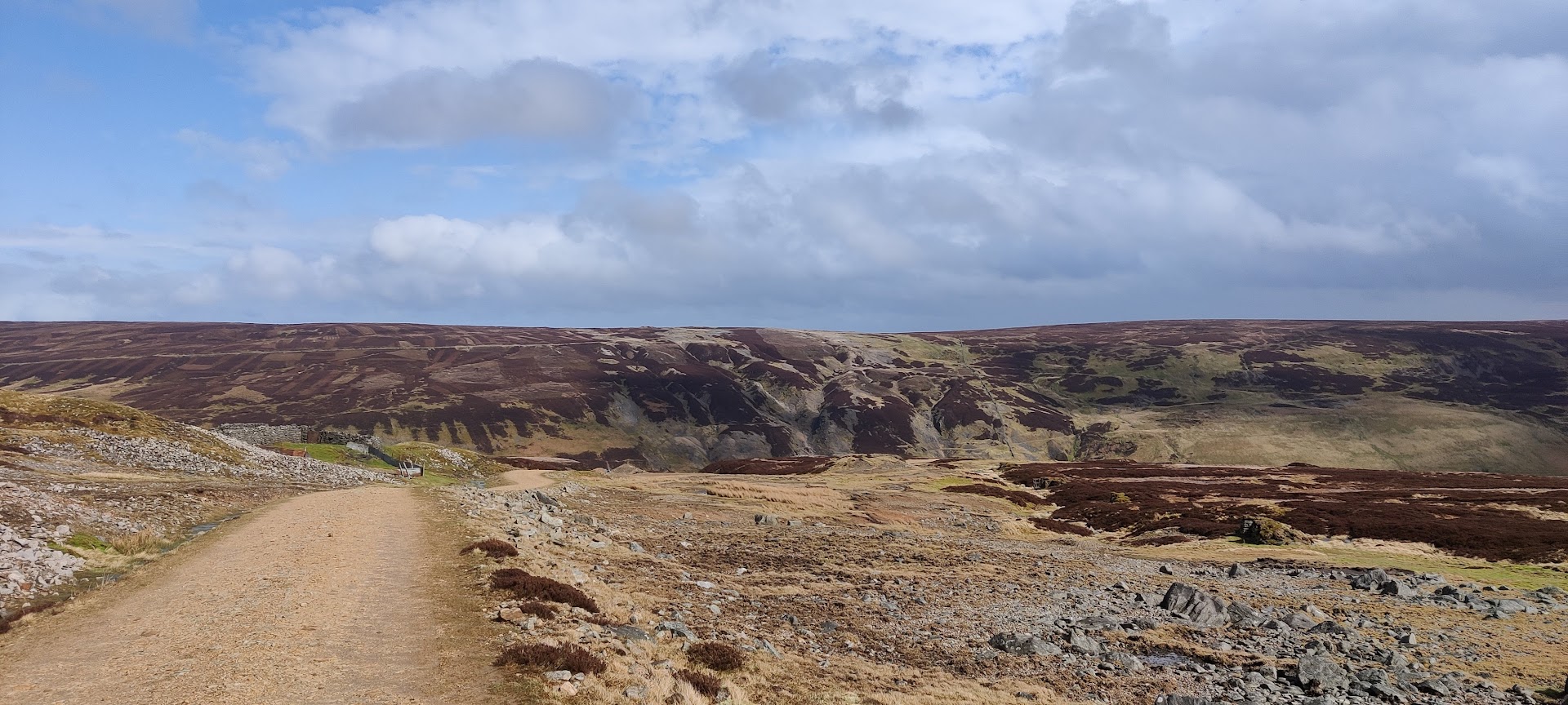
Some bridleways, some meadow crossings, and a road section. And then I turned into the valley between Flat Fell and Raven Crag. This is my first taste of the Lake District. So beautiful already!

Saturday 11:00 The water point at Ennerdale Bridge CP came exactly at the right moment. My 2 flasks were empty. I filled 3 flasks with water, I added some sports drink powder to 2 of them. And then off again, towards and then along Ennerdale Water. The underground varied between lots of rock and mud. Not very runnable but I was able to move along well.
As a side note: the photo the organization used to announce the opening of registrations for next year's edition was taken along Ennerdale Water. Big smile, as you can see.

Until now I had always run together with someone or had another runner in view. That changed after leaving Ennerdale Water behind. So, I took out my map to start navigating where needed. A shoutout to the organization for supplying us with a very clear map of the route. Because although the Coast to coast walk is a waymarked trail, there are certainly not enough marks to navigate on them. I quickly chose to navigate by map during daylight, and later by GPS-watch during the nights.
The course took us up the valley of the River Liza. Part of the way I ran together with Matt again.
Saturday 13:00 And then it was time for the first real ascent, over the pass next to Grey Knotts towards Honister Pass. The wind was picking up strongly, blowing 19kn/5Bft with gusts to 44kn/9Bft2. I nearly lost my front number for the first time there.

But what a view! I feel happy and grateful to be able to run in such beautiful scenery.

Then a long, and partly boggy, descent and I was in Borrowdale CP, Saturday 14:15 time for refueling: some coffee, pizza and 2 cheese-pickles sandwiches. Refilling my 3 flasks and I was ready for the next stretch towards Patterdale.

Now we were deep into the Lakes District's nature. I was enjoying every bit of it, even if the wind was blowing rather hard (24kn/6Bft with 54kn/10Bft gusts) and it started raining.

Saturday 17:00 Ready for the third great ascent to Grisedale Tarn under Fairfield Peak.

On the pass the path was made by big flagstones. The wind was blowing so hard on the high slopes, that on Grisedale Tarn (which is a small lake), a V-formed shore-to-shore wave blew over the water. Magnificent view, but impossible to capture in a photo.

During the descent to Patterdale CP, my phone started acting very weirdly.

Saturday 18:45 I was happy to be at Patterdale CP, as I could use some shelter and hot drink and food. When entering the CP, we heard that Race Direction had decided the diversion route would be used between Patterdale and Shap. Due to the bad weather forecast (rain and high wind speeds), it was deemed not safe enough to let us run/hike up to Kidsty Pike, with its 780m the highest point of the route. The diversion route is 2km longer, but not over Kidsty Pike, so less elevation. This portion of the world was not on the map. But it was getting dark soon anyway, so navigation would have to be done by GPS-watch.
This section had taken me exactly the amount of time I had anticipated, calculating in the rests at intermediate CPs. I felt full of energy and wanted to push on. Part of running an ultra is running through the night, right!
While eating I tried to investigate my phone issues. One of the manifestations was apps crashing (camera app, browser,...) and another one was the battery state swinging all values between 70% and 20%. I decided to try a reboot. But I had forgotten that I switched SIMs some weeks ago. I just didn't know my PIN code. This was not a good situation. Luckily, we were able to negotiate with the local crew to access the CP's Wifi. I sent a message to Mieke, explaining the PIN code situation. My brother would go to my office and search for the little card on which the PIN code is printed and would send it. The only thing I would need to do was:
- getting on a Wifi network in the next CP.
- not needing to communicate between now and then.
- 60.41km
- 1947m Elev+
- planned: 8h15 + 30 min rest = 8h45
- real: 11h15
- 1 support point in between
- ~3 hours of sleep in Kirkby Stephen
no pictures: it was dark, it was very windy, there was rain and hail.
Saturday 19:30 The combination of a bad weather forecast, darkness, and the diversion route, made me propose to Matt and James, who were also eating in the CP, to team up and run the next part together. Darren joined us too, and so we set out in a four-men team.
Navigation was sometimes tricky: the GPX of the diversion route was very rough, cutting corners over bigger distances. But together we made sense of it.
It was hard going. We hiked the uphills and the parts where the wind blew us nearly away. We ran where possible, to stay warm and keep moving. On the high grounds between Heughscar Hill and Knotts, some of us realized that they were getting cold. It dawned on me that the same was true for me. I just hadn't noticed it yet, focused as I was on running and fighting the elements. We stopped to put on some extra layers. I was now wearing 4 layers, my waterproof pants and gloves. And yes, a bit later I felt a lot more comfortable!
Saturday 23:45 We needed 4h15 to cover the 27km (and 858m Elev+) to Shap CP. Soup, tea, hot rice pudding and some rest on a chair: all very welcome. At first it was my plan to sleep here, but in the end, there were no beds available, so we had to keep moving. I didn't want to linger too long. James needed some more rest, so we set out with just the three of us: Matt, Darren, and me, to reach Kirkby Stephen by morning.
We took turns in navigating and making pace, so the other two could just trot on mindlessly. That worked as "a good wolf pack", as Darren would point out later.
The night on the hills was... special. Imagine: you're just in the open. And there's rain, and hail. And it is coming horizontally in your face. Yeah, that was hard. And the underground was all slippery, and mud, mud, mud. Top-England, I think.
Some of this mud, I saw from very close, having slipped and fallen multiple times. On moments like these, my shoe choice (Altra Timp 3) was not optimal: the lugs were just not big enough for a good grip in the mud. On other moments I was very happy with them: they drain very fast, and the large toe box is comfortable.
A night on the fells to remember!
I am very grateful for the company and small talk, the navigation help, the mutual encouragements, the "don't you need to eat/drink" reminders. Thanks James, Matt and Darren!
We reached Kirkby Stephen CP around Sunday 06:15. It has been a long day of running and hiking. I felt I could use some sleep.
- 55.58km
- 2601m Elev+
- planned: 8h + 30min rest = 8h30
- real: 10h15
- 1 support point in between
- ~6 hours of sleep in Richmond
With a wifi hotspot of a friendly man of the organization team, I managed to retrieve the PIN code of my SIM. The reset and/or full battery charge had apparently fixed my phone's weird behaviour. I was able to communicate again.
Sunday 09:50 Almost 3 hours of sleep and a full plate of mac-'n'-cheese got me going again. On to the second National Park of the Traverse: the Yorkshire Dales. I set out just before the start of the Dales Traverse. That was nice, as each fresh runner passing me shouted some encouragement or praises. It lifted my already refreshed spirit even higher. I felt as if I could handle everything right then.
Up the hills towards the Nine Standards Rigg. The weather was dry, but the underground not so much. My fresh socks were dry for less than half an hour. The wind was blowing fiercely again (18kn/5Bft with 43kn/9Bft gusts). I nearly lost my front number again. It was now torn in several places. I choose to unfasten it and stow it away somewhere.

Sunday 12:00 Downhill from the plateau after the Nine Standards Rigg, I mindlessly followed another runner. So, we both got way off course, a detour of about 1.8km and 150m of extra ascent. Apparently, I hadn't felt the warning buzz of my watch due to the wind.

For this first part in the Dales, the underground was not very runnable. Lots of bog or mud, a big part of it along the elevation line on a slope. This meant watching my balance and loosing it multiple times. One memorable moment: I slipped away in the direction of the valley, flipped over in the air, planted both my hands in the mud, swearing loudly. Falling with my mouth open, I was treated to a mouthful of delicious Yorkshire Dales mud. Not my smartest move.

Sunday 14:00 For some time now I had a mental low. My quads started to hurt: the first soreness was there. This part seemed to take me longer than anticipated, and I longed for some more runnable terrain. And as always during an ultra-run, it never always gets worse. Some change in terrain, two rocky ascents later, and the course brought me on a nice gravel path, where I could pick up some speed.
Along the way I observed several signs of the old mining activity in the area. Mostly ruins now.
A thing that occupied my mind during this section and would so for the rest of the Traverse was the optimization of body temperature through clothing decisions.
- Am I too hot, should I take a layer off to feel more comfortable?
- Or on other moments: am I getting cold, should I put on another layer?
- It starts raining, is it hard enough to stop and put my jacket on? And what about my pants or waterproof gloves?
Deciding to stop, open my pack, get stuff in and/or out, pack it again is not always easy. Stopping means breaking the rhythm. But not stopping could mean I get uncomfortable, too hot or too cold. That would be counterproductive too.

Sunday 17:00 Reeth CP: some delicious peas soup. And a real coffee with 3 different kinds of pastry. (In all other CPs the coffee was some sort of instant drink, not really to my liking.)
Ready to get on my feet again and continue to Richmond. By then I had decided to get some hours of good sleep there.
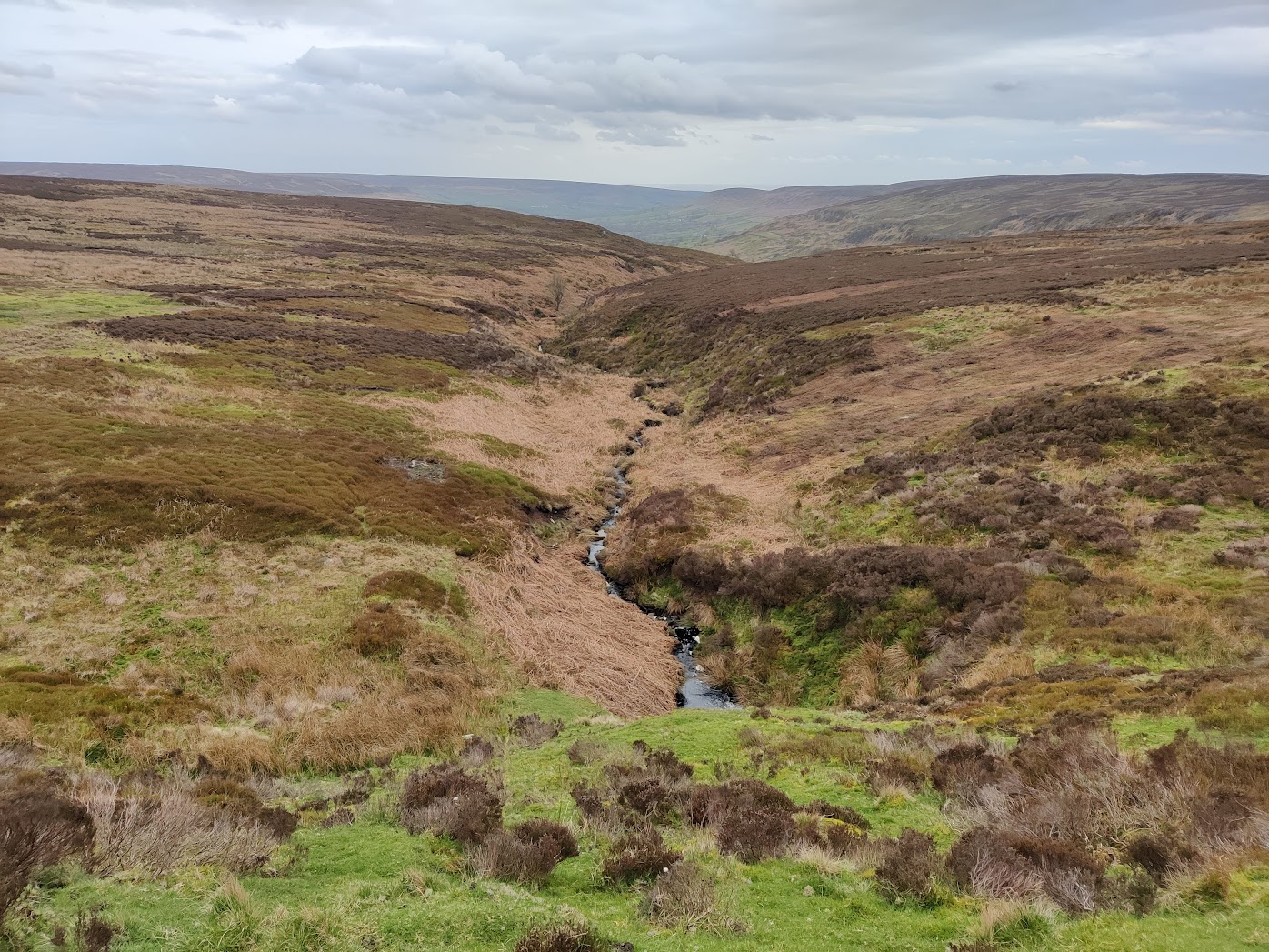
The next stretch brought me through several meadows, some paths, bridleways, and even a small forest. There was still a lot of water searching its way down.

The sun set over the Dales as I descended towards Richmond. The end of a good day of running. I feel happy and tired.

Sunday 20:15 In Richmond I entertained some Dales Traverse runners which I also met in Reeth with the story of the first night in the Lakes District. I would not notice until later that a cameraman was recording me. 😆
My home team had figured out I was running in 7th position (males), so I knew I would lose some places while sleeping. But that was not my main focus. I felt I needed the rest to be able to push on to the end the next day. I took a hot shower. I decided to set my alarm for 04:00. If I would wake up earlier, I would go on. If not, I would have a nice 6 hour sleep.
- 50.2km
- 902m Elev+
- planned: 6h45
- real: 8h
- no support points
Monday 05:15 A good 6 hours of sleep, breakfast of tea, cheese sandwiches and hot rice pudding, and I was ready to set out again. I felt well rested and energized. I started off in the dark, which led to some navigational confusion early on. But after about an hour of running, I could stow my head torch away. There came the sun.

This section should be easy: a long descent and then traversing the plains between the Dales and the Moors. No real elevation until the last bit, where the Coast to Coast Walk joins the Cleveland Way. On the plains I moved well, and I caught up with several other runners. Most of them were hiking where I ran. There was a rather long stretch of road from Bolton-on-Swale to Danby Wiske. Then I got bridleways and muddy footpaths, with the occasional meadow crossing.

During the morning, I had to stop several times to take off pieces of clothing. By the time I started the big ascent towards the Cleveland Way and onto the North York Moors, I was in shorts and long-sleeved t-shirt. I noticed my water was depleting faster than the distance diminished. I had taken 4 flasks for this long section without additional support points. So I started rationing a bit, to make sure I would have enough until Lordstones CP.
Monday 11:45 Here I was, on the North York Moors. Running the same flagstone path Mieke had hiked 3 days ago. 🧡💚

The ascent up Round Hill to Live Moor was paved with flagstones, which made it a bit more difficult to keep my natural climbing rhythm.

A beautiful view of the Moors, with so many different colors.

Monday 13:15 And then a technical descent, again with flagstones, towards Lord Stones CP. Time for delicious lasagna with some coke and a pear-and-apple crumble as desert with a cup of tea.
- 65.47km
- 1625m Elev+
- planned: 9h15 + 30min rest = 9h45
- real: 14h
- 1 support point in between
Monday 14:00 I was still feeling great and had a lot of fun talking to the local crew. The logical decision was to set out again and finish this: my plan was to continue until the end now.
The route led me along the edge of the Moors, up and down each hill.
During the day my feet had started to feel very sore. A new ache means I didn't feel my quads that much. Now it was mostly the topside of my feet, and later on the top of my ankle articulations that hurt the most.

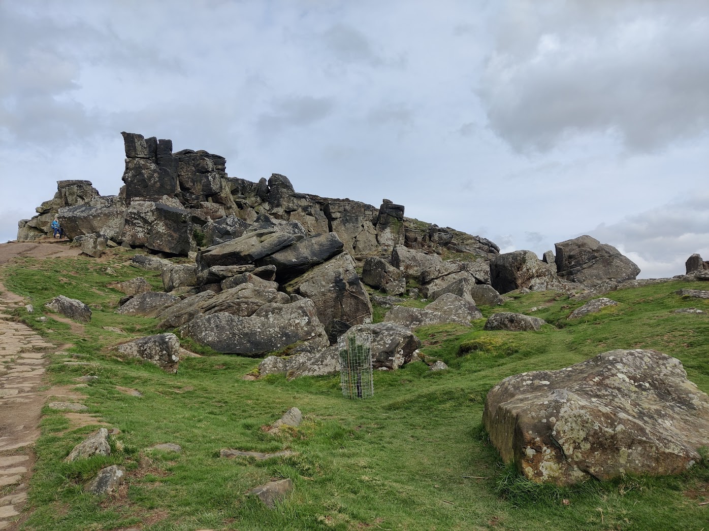
A beautiful climb up and some rock scrambling over Wain Stones.
A steep flagstone descent down to Clay Bank was extra painfull for my feet and ankles.

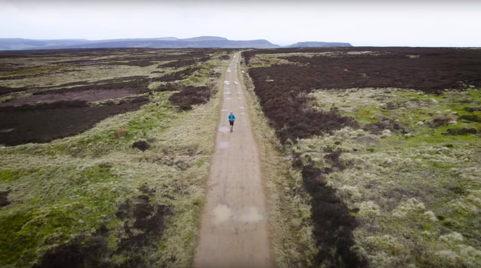
Monday 16:00 A last big ascent and I was on the Moors plateau. That would be the course for the following 3 hours: flat, gravel, so many shades of brown on each side.
But also, the marvelously funny Black Grouse.

This part was mentally taxing to say the least. Especially the dismantled railway between Bloworth Crossing and The Lion Inn was rather boring. It was getting colder, so I stopped several times to put on extra layers. I noticed my pace dropping and my morale was low. So low that I reached out to Mieke:
Monday 19:00

As is often the case, Mieke's advice was spot on. I put my eyes on the horizon. I started singing one of my favorite meditation mantras out loud and picked up the hiking pace. Sometime later, after a succesful body scan, I started running again.
I am the light of my soul. I am beautiful, I am bountiful, I am bliss! I am, I am!
I got off the plateau and onto some public footpath bog.

It started to get dark. I stopped to get my head torch out. It was not on top of my stuff in my pack, where it had been the whole time. A slight panic overtook me. I upended my pack completely. Everything was there except for my head torch! I must have lost it somehow, on the Moors, while putting on an extra layer. Too preoccupied with my own miserable state, I hadn't paid attention enough to make sure I packed everything away again. STUPID!
Monday 20:15 There was only one thing I could do: get going as fast as possible to reach Glaisdale CP before it would be pitch dark. Later I would see I managed to keep a slightly faster than 6min/km pace for that last descent. I didn't know I still had that kind of speed in my legs. Amazing what the human body is capable of in times of need.
At the CP I told my story to the crew and the one present runner: Benji. He was packing and readying himself to get out again for the last stretch. After hearing my story, Benji gave me his spare head torch. (Mine was in my drop bag, speaking of bad choices.) It was a small lamp, which according to Benji, would last about 3 hours. It was clear to the both of us that this would not take me far. So I thanked him but opted to do the only thing left to do: wait in the CP until dawn to get out again.
And then Benji suggested to get out together. What a hero!
Monday 20:45 I stuffed some extra cheese sandwiches in my mouth, finished my cup of tea, and we set out in the night. I had Benji's spare head torch, on the middle light setting. That gave me just enough light to see where I put my feet down, staying as close to Benji as possible to benefit from his light to see further.
Out of Grosmont, we climbed the long ascent back up to the Moors. Halfway up the hill I remembered some blisters I had started feeling some hours ago under my right foot. With all the excitement around my head torch, I completely forgot to check it in Glaisdale. It started to hurt more and more, up to the point where I had to stop and mend it. Down, shoe off, sock off, cleaning with my spare shirt and some water. A row of small blisters in the crease between foot and toes. I was not able to pop them. So I taped that part of my foot with 4 layers of tape. Back in the wet sock and shoe, and on my feet again. The tape helped to keep the pressure off the blisters a bit, so they hurt less. I felt the other aches again.
The ascent seemed endless.
What was Alfred thinking when he decided to put this part into his walk?
Finally, we could take on the descent towards Littlebeck and into the valley of the May Beck back up again. We had some navigational difficulties. We decided to cross an embankment and climb cross country to get to the course again.
Monday 23:00 And then came the long (almost 5km) traverse of a very boggy part of the Moors. To add insult to injury, it started pouring rain again. On these boggy paths we both had our own hallucinations:
- Benji saw moving head torches in the bog left of us. I saw nothing moving there, only distant street lanterns.
- I saw a hole in the ground at a certain moment, so I stopped dead. But after calling out to Benji, I looked down again and there was no hole, just the same boggy path as before.
It rained so much and hard that at a certain point both my waterproof pants and gloves started to leak. I was getting cold, so decided to put on my last extra layer. I was now wearing 6 layers (merino base layer, light running t-shirt, heavier running t-shirt, synthetic down, waterproof jacket). I had no spare dry gloves, so kept the wet ones on.
Around Tuesday 01:30 my head torch's batteries were dead. So from now on we continued with only one head torch to light us.
Tuesday 02:45 A road section brought us into Hawsker. We had to look around a bit to see where the course was. Luckily, I saw a man waving us on at the next crossroad. Benji said:
There's nobody there, Christopher!
So, this was my second hallucination.
Tuesday 03:00 At last we reached the coastal path that would bring us to Robin Hood's Bay. Contrary to what we expected to be an easy path, it was a slippery mud fest. Up and down along the coast, trying to stay up right. We pushed each other on, strongly focused on reaching the finish.
Tuesday 04:12:47 Robin Hood's Bay, finally! Down to the North Sea. Yes, we made it!

A medal around my neck, I step in the churning waves of the North Sea. I don't throw my pebble away, as is tradition. It has served me well as a connection with the meaning of this run: coast to coast. I want to keep it.
Together with some of the crew, we walked back up the hill towards the race HQ. There I got some great hot food, tea, and coke. I took off my shoes and socks: my ankles were swollen to such a degree that there was no distinction visible anymore between the end of my legs and the start of my feet. I eagerly took up the invitation of the crew to get a shower and a couple of hours of sleep in a bed in the Youth Hostel.
Wednesday 11:30 After eating a lot and sleeping as good as it went, I descend to the beach of Robin Hood's Bay again, to await Mieke. Meanwhile I chat with crew members and I congratulate some finishers.
Wednesday 12:12 There is Mieke, after a hike of 120km on her own on the Cleveland Way, she reaches our common finish line! What a spectacular feat!

Mieke made us a very nice t-shirt, designed by Siebe Vander Henst! M 🖤 C - Together Strong.

- 300km
- announced 6500m of ascent, were in reality3:
- 9746m ascent
- 9751m descent
- 67:42:47 elapsed time
- 47:12:00 movement time
- 24:29:57 running4
- 22:42:03 hiking
- 20:30:47 of idle time
- of which ~9 hours sleep
- back pack of 5kg without water
- max 7kg with 4 flasks
- shoes: Altra Timp 3
- pack: Salomon ADV Skin Cross Season 15 (15litre)
- belt: Salomon Senso Pro Belt
- poles: Leki Ultratrail FX One
- socks: Vibram merino toe socks
- only 2 pairs, could have used an extra pair.
- base layer: Tracksmith merino longsleeve
- other clothing: mostly Decathlon running clothes
- waterproof jacket: Waterproof Jacket Forclaz Trek 500 - 20.000mm water resistance, never leaked!
- waterproof pants: Kiprun waterproof trailrun pants - 10.000mm water resistance, leaked eventually.
- waterproof gloves: Extremities WP Power Liner, leaked eventually.
I didn't keep track of how much I ate, but these were the items I carried:
- Supernatural Fuel (Less than planned, due to a long customs delay of my order, which arrived at home when I was already in England)
- generic (baby food) fruit puree
- brownies
- soft (Grany) and crusty muesli bars
- Haribo Roulette
- Babybel (mini babybal protein)
- Snickers
All that in addition to what I ate at the CPs:
- chips
- sandwiches (cheese+pickles, cheese+vegs, cheese)
- wrap with vegs
- mac'n'cheese with mushrooms (hot)
- curry with naan bread (hot)
- rice pudding (hot)
- soup: peas, tomato, mushrooms (hot)
- lasagna (hot)
- pastries
- cold pizza slices
- an orange
- diced cheese
- apple and pear crumble
- assorted pastry
Footnotes
-
All times are in British Summer Time (BST) or UTC+1. ↩
-
All weather information was retrieved later using the Open-Meteo Historical Weather API ↩
-
According to my watch, a Garmin FR945 with barometric altitude sensor. ↩
-
According to Garmin's Run/Walk Detection, based on the combination of cadence and pace ↩