The Russian sources claim that the missile was launched by Ukranian forces. The Ukranian sources claim it was a false flag operation by Russians themselves.
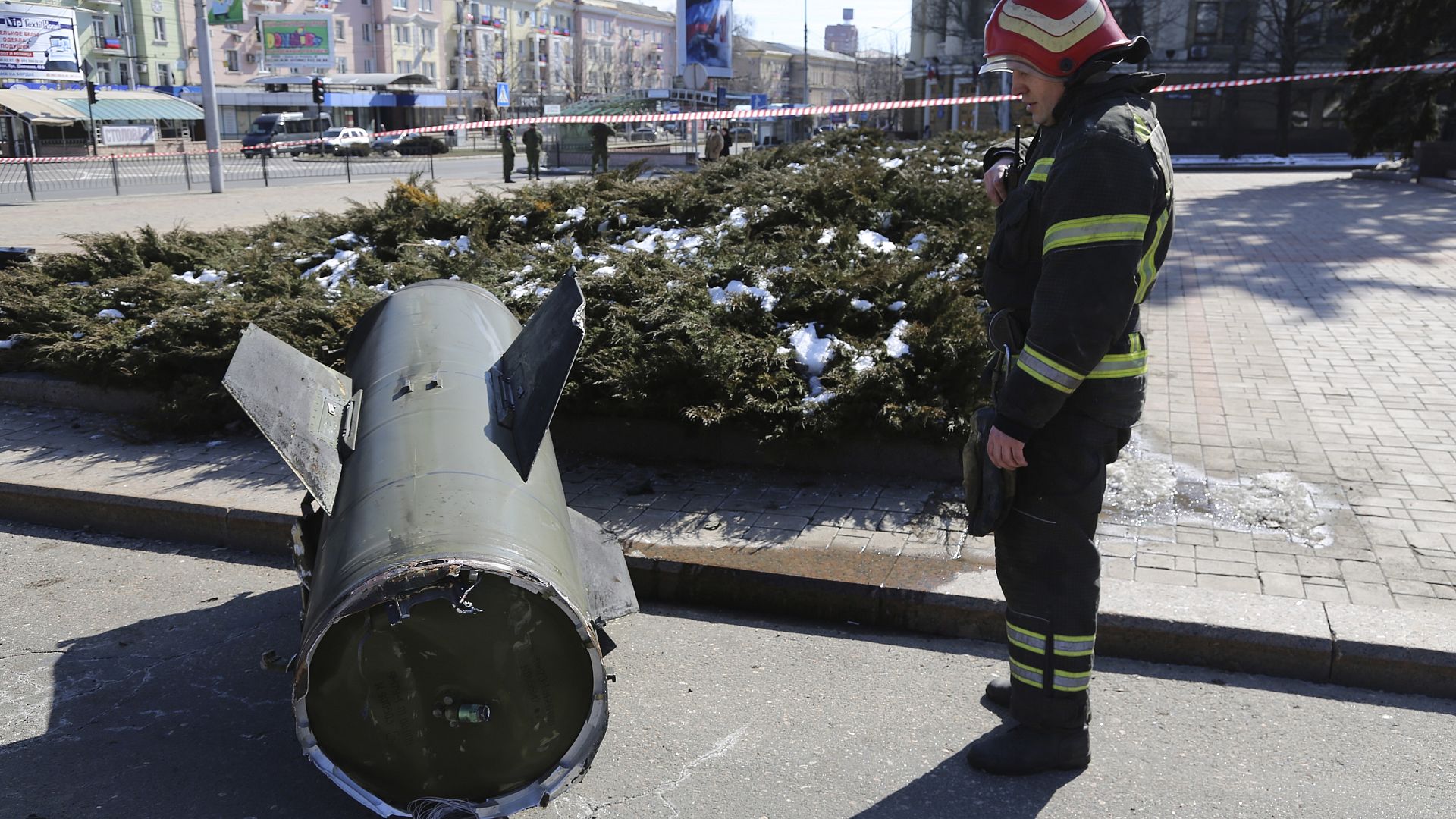
This investigation reveals that the former is highly unlikely, as the engine end of the the 9M79 Tochka-U missile, the range of which is up to 120 km, appears to have traveled from the approximate bearing of 148° southeast by south, which falls far within the Donbas territory of Ukraine that the Russian forces siezed in 2014, and exends farther on into Russia, to area near Rostov-on-Don.
The remains of the missile may have been moved by individuals in Donetsk to incriminate Russian forces, but, in addition to the absurdity of tampering with the evidence to shift the blame towards their own side of allegiance (although, never underestimate Russihuman incompetence), there are no visible signs of this being the case.
The first image helps geolocating (via Google StreetView) the object to 48°00'32.5"N 37°48'13.9"E:

The second image (along with Google Maps) helps to determine the bearing as southeast by south (approx. 148°):
You can use the distance measuring feature of Google Maps to determine the approximate bearing (StreetView might come in handy yet again):
-
Start by placing the first point at the missile wreckage (48°00'32.5"N 37°48'13.9"E).
-
Put the second point at 48°00'29.2"N 37°48'17.0"E, at the building in the line of sight behind the bus stop, 129 Artema St. Or, be bold, and place the other point way over at [Lakedemonovka, Rostov Oblast, Russia].
(Here's a link to both points marked on the map simultaneously.)
The distance measuring line is now colinear with the path traveled by the 9M79 Tochka-U missile, and yields the approximate bearing of 148° southeast by south.