Instead of posting links like ABQ did, I'll explain how the server works that way you can build your own queries.
###YouTube Made 2 videos to get started
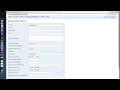
Root Folder
http://coagisweb.cabq.gov/arcgis/rest/services
#Breaking it down Using this template we will fill in the missing variables
http://coagisweb.cabq.gov/arcgis/rest/services/{folder}/{mapserver}/MapServer/{layer}/query
Start here
we want to choose the {folder} http://coagisweb.cabq.gov/arcgis/rest/services/
I'll choose 'public'
http://coagisweb.cabq.gov/arcgis/rest/services/public
Next
we want to choose a {mapserver} http://coagisweb.cabq.gov/arcgis/rest/services/public
I'll choose 'recreation'
http://coagisweb.cabq.gov/arcgis/rest/services/public/recreation/MapServer/
Next
Here we have to choose our layer. Go to the URL we just created. below
http://coagisweb.cabq.gov/arcgis/rest/services/public/recreation/MapServer
Find the bolded word "Layers" and pick one.
NOTE: The integer next to the title will be used in the URL
I'll choose 'parks (0)'
http://coagisweb.cabq.gov/arcgis/rest/services/public/recreation/MapServer/0/
Almost
tag a 'query' on and your ready to go
http://coagisweb.cabq.gov/arcgis/rest/services/public/recreation/MapServer/0/query
#Examples NOT using the query generator
notice the where= ' ' statements
getting all landfills
http://coagisweb.cabq.gov/arcgis/rest/services/public/environmentalissues/MapServer/2/query?where=OBJECTID>1&f=pjson
getting specific bus route Eubank fullviewer is the table with everything(i guess) layer 19 is transit routes
http://coagisweb.cabq.gov/arcgis/rest/services/public/fullviewer/MapServer/19/query?where=RTNAME='Eubank'&f=pjson
#Getting Parks baseUrl http://coagisweb.cabq.gov/arcgis/rest/services/public/recreationMapServer/0
ugly generated query
http://coagisweb.cabq.gov/arcgis/rest/services/public/recreation/MapServer/0/query?where=1%3D1&text=&objectIds=&time=&geometry=&geometryType=esriGeometryEnvelope&inSR=&spatialRel=esriSpatialRelIntersects&relationParam=&outFields=*&returnGeometry=true&maxAllowableOffset=&geometryPrecision=&outSR=&returnIdsOnly=false&returnCountOnly=false&orderByFields=&groupByFieldsForStatistics=&outStatistics=&returnZ=false&returnM=false&gdbVersion=&f=pjson
could be cut shown as
http://coagisweb.cabq.gov/arcgis/rest/services/public/recreation/MapServer/0/query?where=1%3D1&f=pjson
You have this url.
It is not actually West Bluff park it still returns many other parks it's just performing a "text" serach and as a result is returning too much data (takes too much time)
http://coagisweb.cabq.gov/arcgis/rest/services/public/recreation/MapServer/0/query?where=1%3D1&text=WEST+BLUFF&objectIds=&time=&geometry=&geometryType=esriGeometryEnvelope&inSR=&spatialRel=esriSpatialRelIntersects&relationParam=&outFields=*&returnGeometry=true&maxAllowableOffset=&geometryPrecision=&outSR=&returnIdsOnly=false&returnCountOnly=false&orderByFields=&groupByFieldsForStatistics=&outStatistics=&returnZ=false&returnM=false&gdbVersion=&f=pjson
more accurate way use where statement and text param should be blank perferably left out
KEY is: where=UPPER(PARKNAME)=UPPER('west bluff')
http://coagisweb.cabq.gov/arcgis/rest/services/public/recreation/MapServer/0/query?where=UPPER(PARKNAME)=UPPER('west bluff')&f=pjson
###XY to Lat Long add this out spatial reference param (should work on all)
&outSR=4326
###Therefore
this
http://coagisweb.cabq.gov/arcgis/rest/services/public/recreation/MapServer/0/query?where=UPPER(PARKNAME)=UPPER('west bluff')&f=pjson
becomes this
http://coagisweb.cabq.gov/arcgis/rest/services/public/recreation/MapServer/0/query?where=UPPER(PARKNAME)=UPPER('west bluff')&outSR=4326&f=pjson
#Param List Doc list of parameters and their definitions documention from ArcGIS